Eshma Technologies Private Limited is a pioneering company that offers cutting-edge drone solutions for surveying, mapping, and inspection services in India. Explore the wide range of domains we specialize in and see for yourself if you think we can take on your project.
Our Sevices
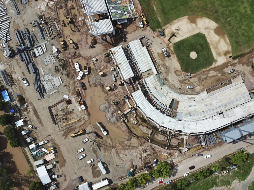
Mapping and Surveying
Enhance construction efficiency through the implementation of drone-powered solutions, streamlining processes and achieving significant time and cost savings
Elevate Projects
Use drones for aerial insights
Aerial Data
Access real-time insights
Boost Safety
Inspect hard-to-reach areas
Progress Monitoring
Track construction progress
Accurate Measurements
Manage stockpiles and topography
3D Visualization
Create detailed models
Energy Efficiency
Detect heat loss with thermal imaging
Regulatory Compliance
Simplify compliance
Our Services
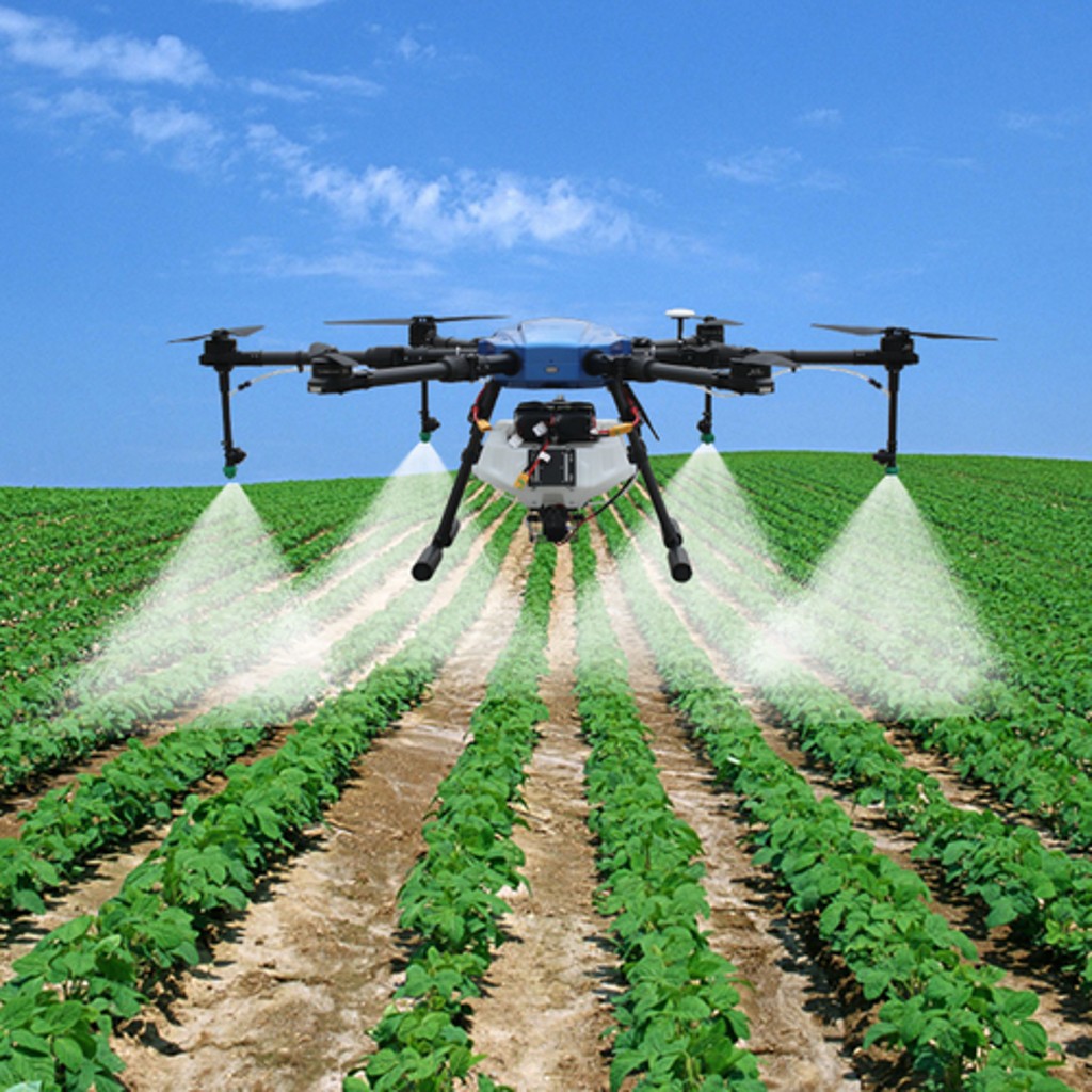
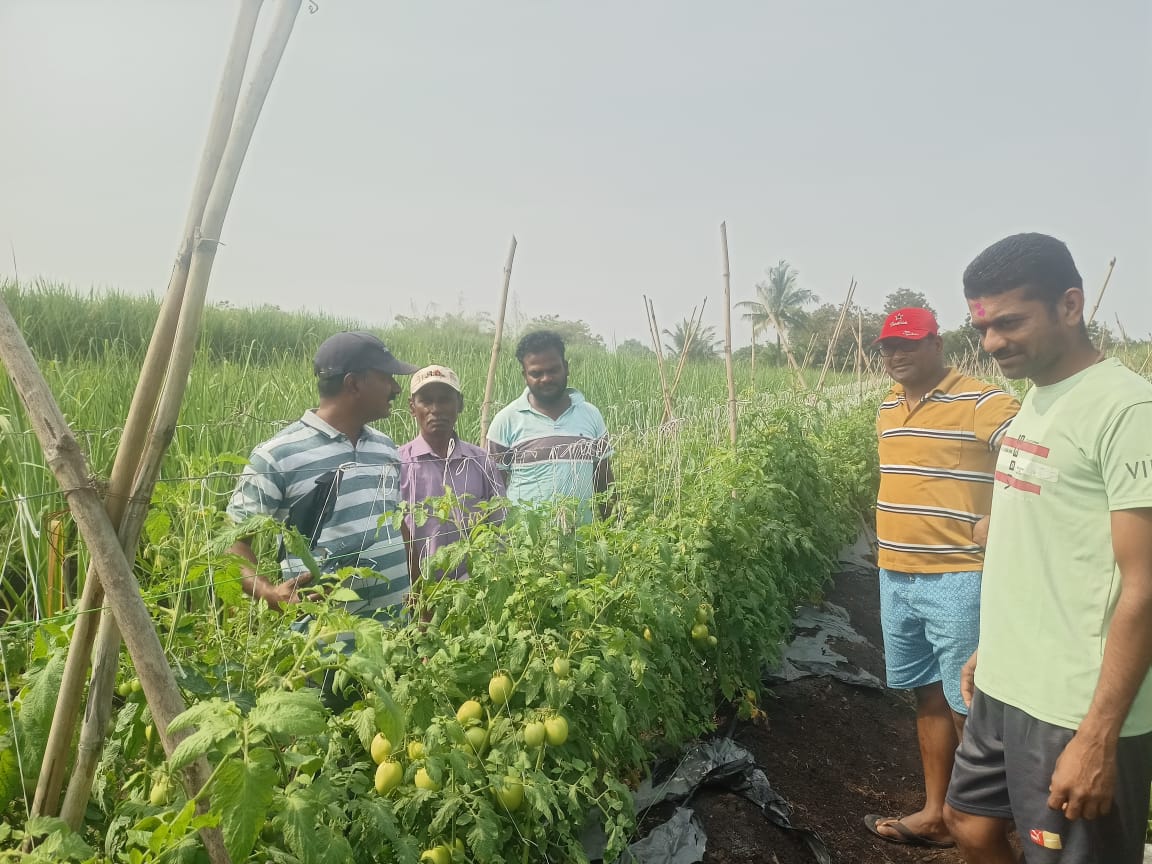
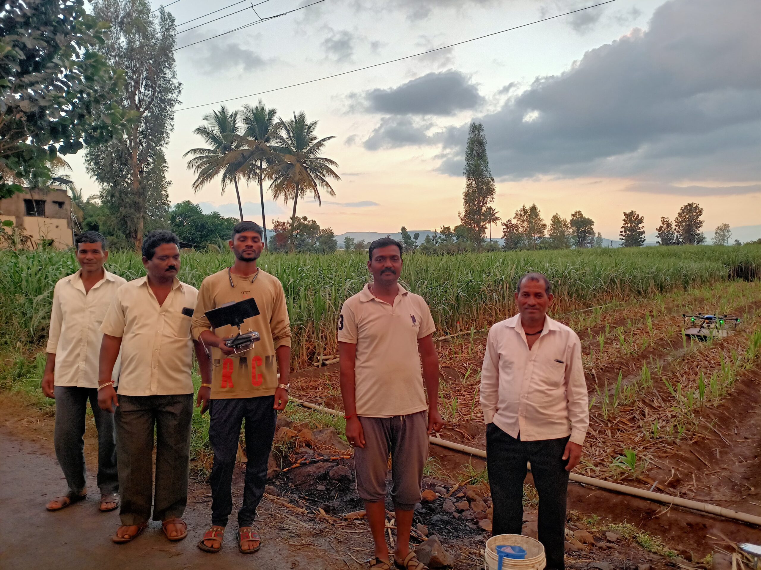
Agriculture Spraying
Our Agri drones, offer a cutting-edge solution for applying fertilizers, pesticides, and herbicides to crops. Say goodbye to inefficient manual spraying and embrace our precise drone technology
Precision Spraying
Achieve accurate liquid application
Time Savings
Complete tasks quickly and efficiently
Reduced Costs
Save on labor and resources
Eco-Friendly
Eco-Friendly
Safety First
Reduce human exposure to chemicals
Remote Access
Reach challenging terrain with ease
Increased Yields
Enhance crop production
Crop Monitoring
Track growth and performance
Our Services
Inspection
Experience a plethora of benefits with our Bridge Inspection Service powered by drones. Drones elevate safety by evading hazardous environments and enhance efficiency by rapidly covering expansive areas
High-Res Imaging
Capture detailed aerial images
Enhanced Safety
Reduce risks for inspection teams
Cost Savings
Cut inspection expenses
Rapid Deployment
Start inspections quickly
Detailed Data
Gather precise structural information
Efficient Surveys
Complete inspections faster
Remote Access
Reach challenging areas easily
Visual Evidence
Support decision-making

Our Services
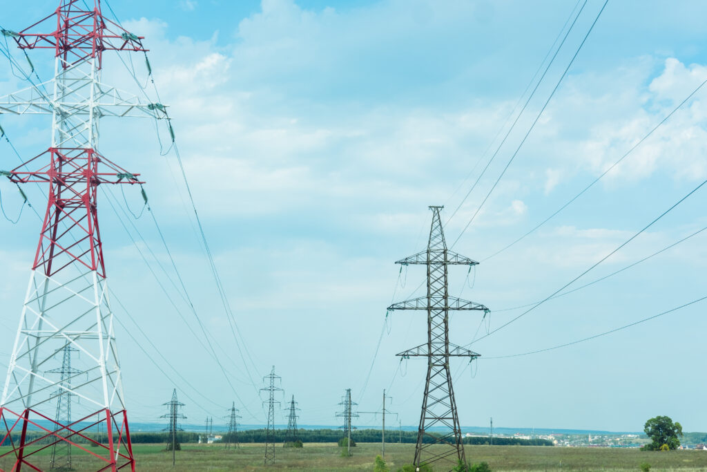
Power Line Monitoring
Elevate your power line inspection and maintenance with our cutting-edge drone service. Our fleet of drones equipped with advanced imaging and sensing technology provides efficient and cost-effective monitoring of power infrastructure. Detect issues early, reduce downtime, ensure regulatory compliance, and enhance safety. With real-time data and comprehensive reporting, our service empowers you to make informed decisions, optimize asset management, and improve the reliability and efficiency of your power grid
Efficient Surveys
Conduct inspections quickly
Reduced Downtime
Minimize service interruptions
Cost Savings
Lower inspection expenses
Remote Access
Reach remote areas with ease
Enhanced Safety
Reduce risks for workers
Real-Time Data
Make informed decisions
Detailed Inspections
Detect issues early
Visual Documentation
Create comprehensive records
Our Deliverables
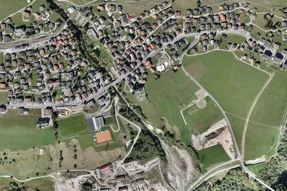
Orthomosaic Maps
Orthomosaic maps are high-resolution, georeferenced aerial images stitched together to create a detailed and accurate representation of large areas. These maps offer invaluable insights for various industries, including agriculture, construction, and land management, facilitating better decision-making and analysis.

Digital Surface Model (DSM)
A digital surface model (DSM) captures the Earth’s surface, including all objects on it, providing a detailed topographical representation. Unlike the digital terrain model, a DSM includes buildings, vegetation, and other natural and man-made features. It’s a 3D visualization of the landscape, revealing both natural landmarks and built structures in their true elevations
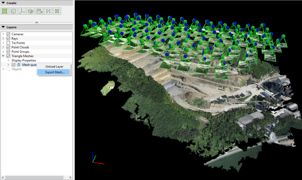
3D Point Cloud
A 3D point cloud is a collection of data points defined in a three-dimensional coordinate system. These points represent the external surface of an object or terrain. Typically generated by methods like LiDAR or photogrammetry, point clouds serve as the foundation for creating detailed 3D models and analyzing spatial information in GIS applications
Digital Terrain Model
A digital terrain model (DTM) represents the bare ground surface of the Earth, devoid of buildings, vegetation, and other objects. By capturing the underlying topography, DTMs are pivotal for hydrological, geological, and land-use planning. Generated from remote sensing data, they offer insights into natural landscapes, aiding in everything from flood prediction to construction planning

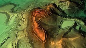
Contour Maps
A contour map is a two-dimensional representation of the Earth’s surface, using contour lines to depict elevation change. Each contour line connects points of equal elevation, enabling readers to infer topographical features and gradients. Widely used in cartography, geology, and land planning, these maps offer a visual understanding of terrain and landscape variations, aiding in navigation and site analysis
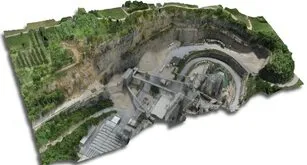
A 3D Texcured Mesh
A 3D textured mesh is a digital representation of a three-dimensional surface, combining geometric data with texture information. This mesh consists of vertices, edges, and faces that define the object’s shape, while the texture overlays the mesh with detailed imagery or colors, providing a realistic appearance. Often derived from photogrammetry or 3D scanning, a 3D textured mesh offers an immersive visualization, crucial for applications in virtual reality, gaming, architectural visualization, and digital heritage preservation
Agriculture Spraying Services


What are you waiting for? Contact us right now and get a free quote for your project
Contact
- support@eshma.co.in
- +91 9665668891
- Khamboli, Pune, 411046
- Mon - Fri : 09.00 - 18.00
Explore
Copyright © 2024 Eshma Technologies Private Limited